 Fun
In
New
England
- Maine
 Fun
In
New
England
- Maine
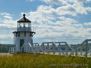
Doubling Point Lighthouse195 Doubling Point RoadArrowsic, ME 04530 www.doublingpoint.org FunInNewEngland Rating: (0 votes) GPS Coordinates: 43.88313, -69.80533 Located on Arrowsic Island in the Kennebec River. It is a small wooden tower at the end of a wooden walkway and was built in 1898. The area near the lighthouse is accessible by car, however, the lighthouse itself is not open to the public. Driving requires a fairly long drive through a somewhat remote heavily wooded and residential area. It can also be viewed from sightseeing boat cruises. Last updated 2016-04-08 Get map or directions from Google Maps, Yahoo Maps, Bing Maps, or Mapquest  Rate it yourself Submit your own review |